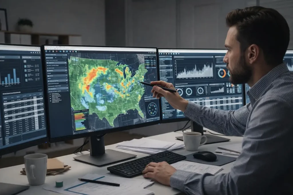
Satellite imagery combined with Geographic Information Systems (GIS) has revolutionized how the United States monitors its agricultural lands and water resources. From tracking crop health and water use to detecting drought patterns and ensuring sustainable management, satellite‑based GIS systems provide essential data for farmers, scientists, and policymakers. In an age of climate change, population growth, and increasing demands for food and water, these technologies are indispensable tools for modern agriculture and resource stewardship.
What Is Satellite Imagery & GIS?
Satellite imagery refers to pictures of Earth captured by satellites orbiting our planet. This imagery covers vast areas and comes in multiple spectral bands, allowing analysts to view, classify, and measure features on the land and water surface with tremendous detail. GIS is the software and analytical framework used to organize, analyze, and visualize this spatial data.
Together, satellite imagery and GIS allow users to see changes in land use, vegetation conditions, soil moisture, watershed trends, and more — all from a distance but with precision.
Why Monitoring US Agriculture Matters
1. Precision Farming
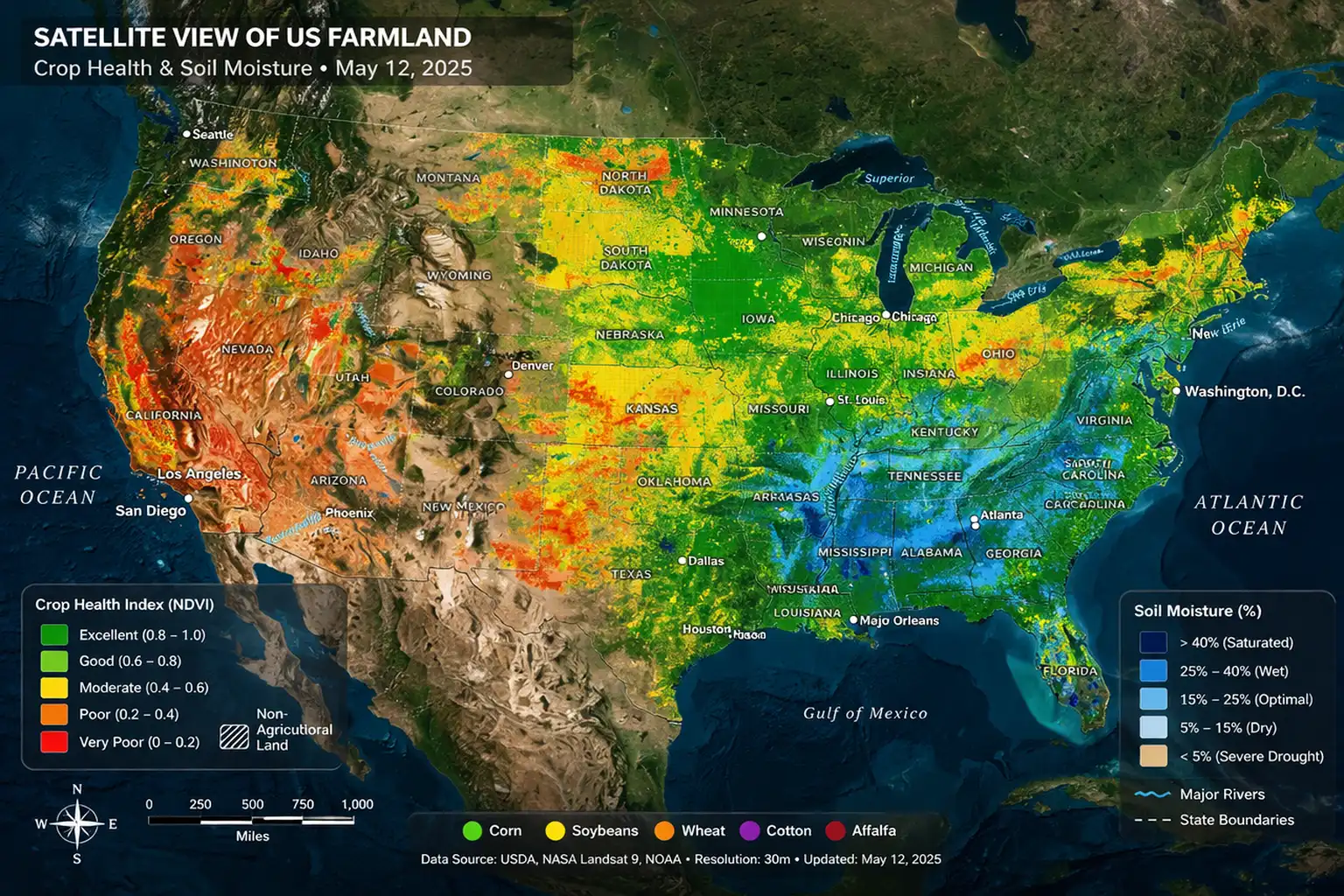
Precision agriculture uses satellite imagery and GIS to help farmers make informed decisions about planting, irrigation, and fertilization. Specific indicators, such as the Normalized Difference Vegetation Index (NDVI), help determine plant health and growth patterns across extensive farmland. These insights help reduce waste, optimize resources, and increase crop yields while minimizing environmental impact.
2. Crop Health & Yield Forecasting
By comparing multispectral imagery over time, agricultural analysts can detect stress in crops due to pests, disease, drought, or nutrient deficiency. GIS helps visualize this data in a way that reveals patterns invisible to the naked eye, enabling early intervention.
3. Sustainable Resource Management
Satellite systems reveal when and where water resources are abundant or stressed, helping determine irrigation schedules, reservoir levels, and watershed health. With the United States facing more frequent droughts and extreme weather, these tools help maximize water efficiency and ensure food security.
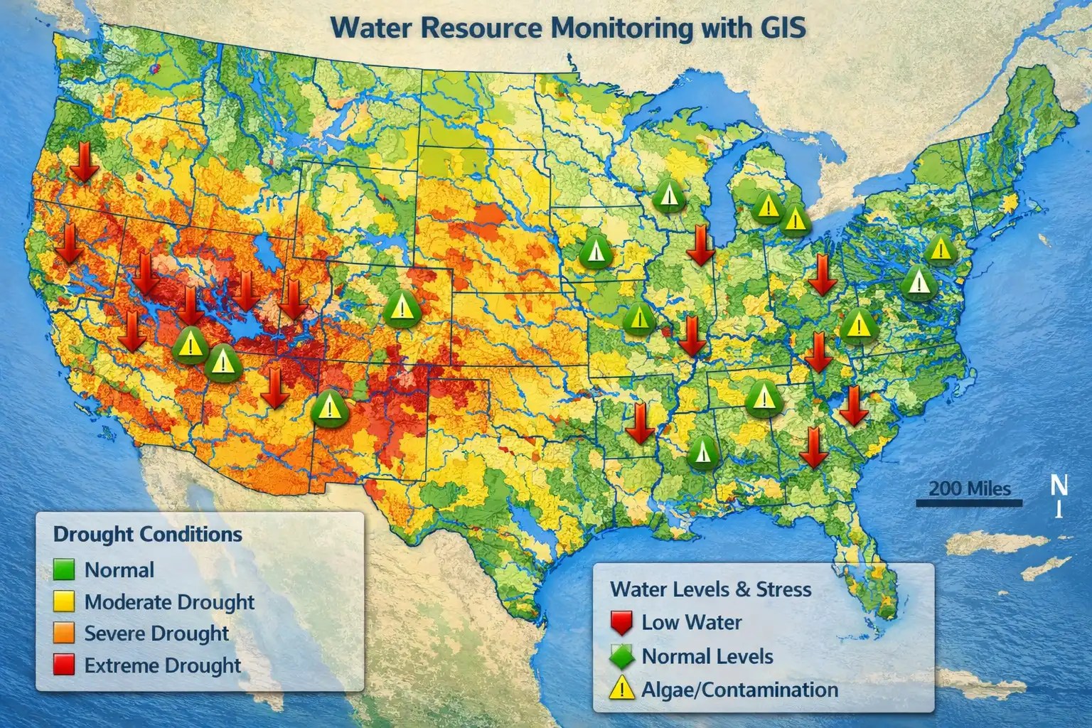
Monitoring Water Resources with Satellite Imagery
Water resources — including rivers, lakes, reservoirs, and aquifers — are critical to American agriculture, cities, and ecosystems. Satellite imagery helps monitor these resources in ways traditional ground‑based stations alone cannot.
1. Tracking Water Availability
Satellites measure changes in surface water extents across seasons and years, enabling analysts to observe shrinkage or expansion of lakes, reservoirs, and river beds. Longer‑term records from programs like Landsat provide decades of data illustrating trends.
2. Assessing Drought and Water Stress
GIS allows users to layer satellite‑derived drought indices with historical climate data, revealing regions under stress that may require water management action. These layers can be critical in planning for agricultural water use or urban supply.
3. Water Quality Monitoring
Some satellite sensors can detect indicators of water quality problems, such as algal blooms or sediment load. By analyzing spectral signatures, GIS analysts can map water conditions to support environmental protection agencies and local stakeholders.
 Major Satellite Programs Supporting US Agriculture & Water Monitoring
The United States government operates several key Earth‑observing programs that provide reliable data for agriculture and water monitoring.
Landsat Program
The Landsat program, a collaboration between NASA and the U.S. Geological Survey (USGS), has provided continuous satellite imagery since 1972. Landsat data help monitor crop health, land cover change, and water use over time. Its spectral bands and revisit frequency make it ideal for observing vegetation and surface water trends.
National Agriculture Imagery Program (NAIP)
NAIP is run by the USDA and acquires aerial imagery of U.S. farmland during the peak of the growing season. This high‑resolution imagery is made publicly available to support crop mapping, land use analysis, and GIS integration tools.
USGS EarthExplorer
EarthExplorer is a free database hosted by the USGS that allows users to search and download satellite imagery, including high‑resolution scenes and historical archives valuable for agricultural and water studies.
NOAA’s Satellite Maps & Imaging Services
The National Environmental Satellite, Data, and Information Service (NESDIS) provides real‑time satellite data and imagery that can be visualized through interactive maps, helping stakeholders monitor weather patterns and environmental conditions.
GIS Tools That Power Analysis
Beyond imagery acquisition, GIS tools transform raw satellite data into actionable insight.
Google Earth Engine
Google Earth Engine provides an unprecedented platform for analyzing petabytes of satellite data at global scale. Researchers and developers can detect changes, map trends, and model outcomes — including crop yield prediction or water depletion — using powerful cloud‑based analytics.
Desktop & Web GIS Software
Commercial and open‑source GIS platforms such as ArcGIS, QGIS, and GRASS allow analysts to integrate satellite imagery with field data, generate spatial models, and create detailed maps for decision‑making.
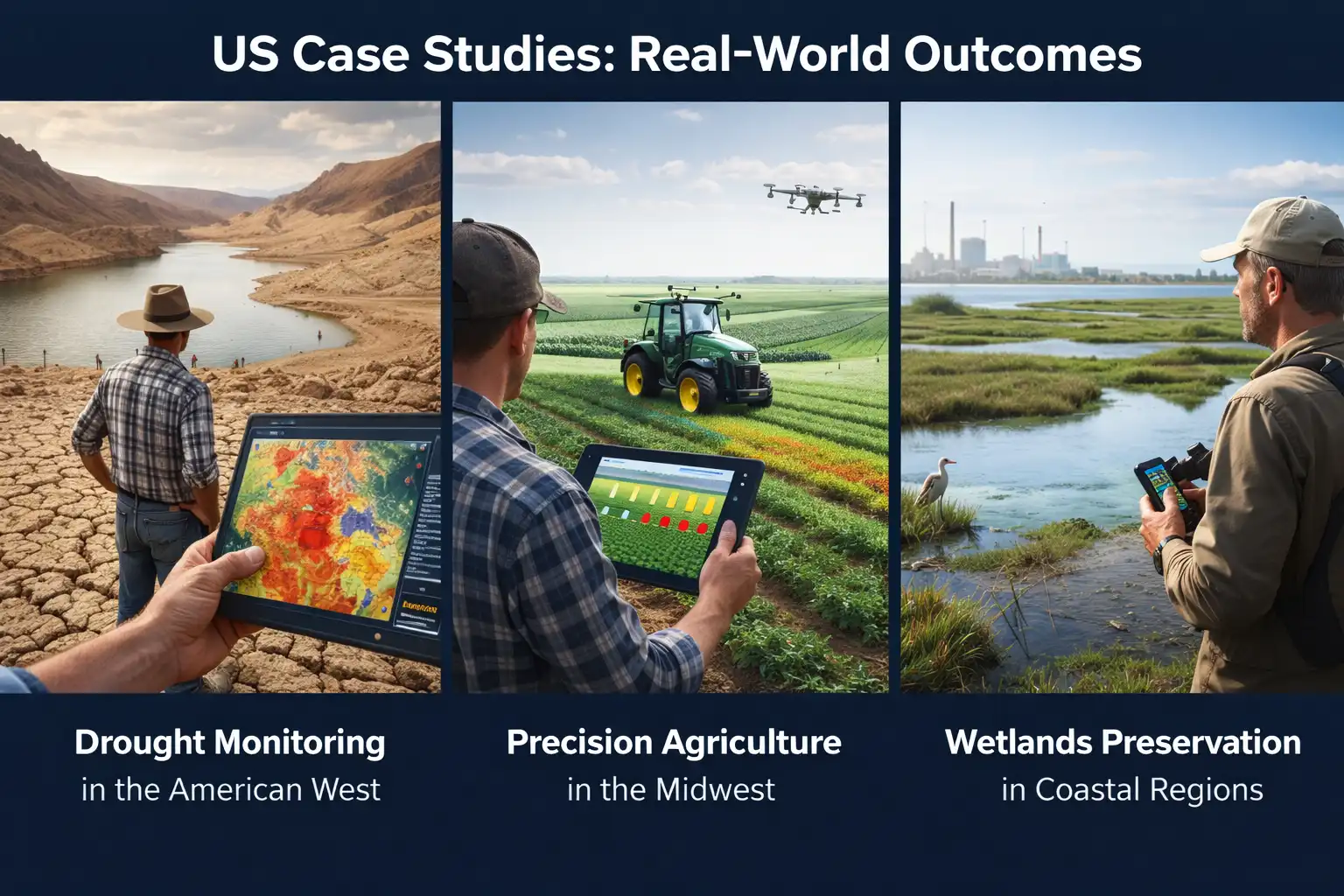
US Case Studies: Real‑World Outcomes
Drought Monitoring in the American West
Satellite‑based drought indices have tracked water stress across the Colorado River Basin for years. With satellite data layered in GIS, federal agencies can forecast shortages, prepare water allocations, and inform policymakers.
Precision Agriculture in the Midwest
Farmers in corn and soybean country use GIS layers derived from satellite imagery to adjust irrigation and fertilizer application. These practices increase efficiency and reduce unnecessary water and chemical use.
Wetlands Preservation in Coastal Regions
By tracking changes in water extent and vegetation patterns, GIS analysis helps environmental stewards map the health of coastal wetlands, aiding conservation and flood risk assessment.
Future Trends
AI and Machine Learning in Satellite Analysis
Emerging technologies are integrating AI to automate crop classification, detect irrigation patterns, and predict yield outcomes from satellite time series. This trend promises faster, more precise insights than ever before.
Higher Resolution Commercial Imagery
While government programs like Landsat provide foundational data, commercial satellites offer higher resolution imagery that enables field‑level analysis — essential for precision agriculture and localized water resource decisions.
Conclusion
Satellite imagery combined with GIS has transformed how the United States monitors agriculture and water resources. These technologies empower stakeholders — from farmers and land managers to federal agencies — with data that drive sustainable, efficient, and informed decisions. As satellite capabilities continue to evolve and computational platforms grow more powerful, the impact of these tools on food security and water sustainability will only increase.